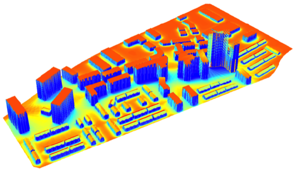
solar radiation map
how to create a radiation map for an urban site using openstudio, like this

Regards, Shahin
First time here? Check out the Help page!
how to create a radiation map for an urban site using openstudio, like this

Regards, Shahin
@macumber has been working on a lot of urban scale stuff with OpenStudio, including visualization. He may weigh in with options. You could very easily create these kinds of visualizations using Radiance, too. The problem with both of these solutions is they involve Extra Work[TM] beyond the base functionality of OpenStudio. But since we're talking about it, you could create an OpenStudio model of one building, and the site comprised of site shading surfaces. Run that model with the Radiance measure (included with OpenStudio) and ensure the "Cleanup Data" option is NOT selected. After the simulation, you will still have the OpenStudio model exported as a Radiance model and you could issue a separate command to render the model as a radiation map.
This process is a bit of a square peg/round hole scenario, I will grant you. But if you want to use OpenStudio, this is one workflow to get you where you wish to go. If you have facility with Radiance at the command line, or access to other tools such as Grasshopper or DIVA for Rhino, those routes may be less painful.
Other option is using an alternate software for simulation, i suggest Ecotect because has a great graphical interface and it works with Radiance too, but an simulation work with Ecotect will have much less accuracy in comparation with the actual accuracy and validation of the results obtained using the core simulation EnergyPlus and their graphical interfaces like OpenStudio and DesignBuilder.
Please start posting anonymously - your entry will be published after you log in or create a new account.
Asked: 2016-08-04 00:29:29 -0500
Seen: 1,542 times
Last updated: Aug 07 '16
