Question-and-Answer Resource for the Building Energy Modeling Community
| | 1 | initial version |
Couple of pointers as to where I would start:
Model it in sketchup and enable shading so you can get visual 3D feel for what's happening.
Use any software such as Climate Consultant to easily produce a Sun Shading Chart. It also has an "obstruction elevation" where you can enter neighboring buildings (distance, elevations, and which orientation) and it'll show you how much of your sun you're blocking.
Below I've added two obstructions, one that has no impact (100 ft high, 15 ft away, but East orientation) and one that has some impact (full south, 50ft high, 100 ft away)
If you feel like going further, it'll be a good occasion to refresh your skills in trigonometry in 3D polar coordinates
| | 2 | No.2 Revision |
Couple of pointers as to where I would start:
Model it in sketchup and enable shading so you can get visual 3D feel for what's happening.
Use any software such as Climate Consultant to easily produce a Sun Shading Chart. It also has an "obstruction elevation" where you can enter neighboring buildings (distance, elevations, and which orientation) and it'll show you how much of your sun you're blocking.
Below I've added two obstructions, one that has no impact (100 ft high, 15 ft away, but East orientation) and one that has some impact (full south, 50ft high, 100 ft away)
If you feel like going further, it'll be a good occasion to refresh your skills in trigonometry in 3D polar coordinates
Edit:
I just remembered that there's some Python framework called PV_LIB to model solar PV. Sure enough, there's already a function to calculate the position of the sun given location: latitude, longitude and elevation (and time zone). Check the source code for the pvl_ephemeris function here
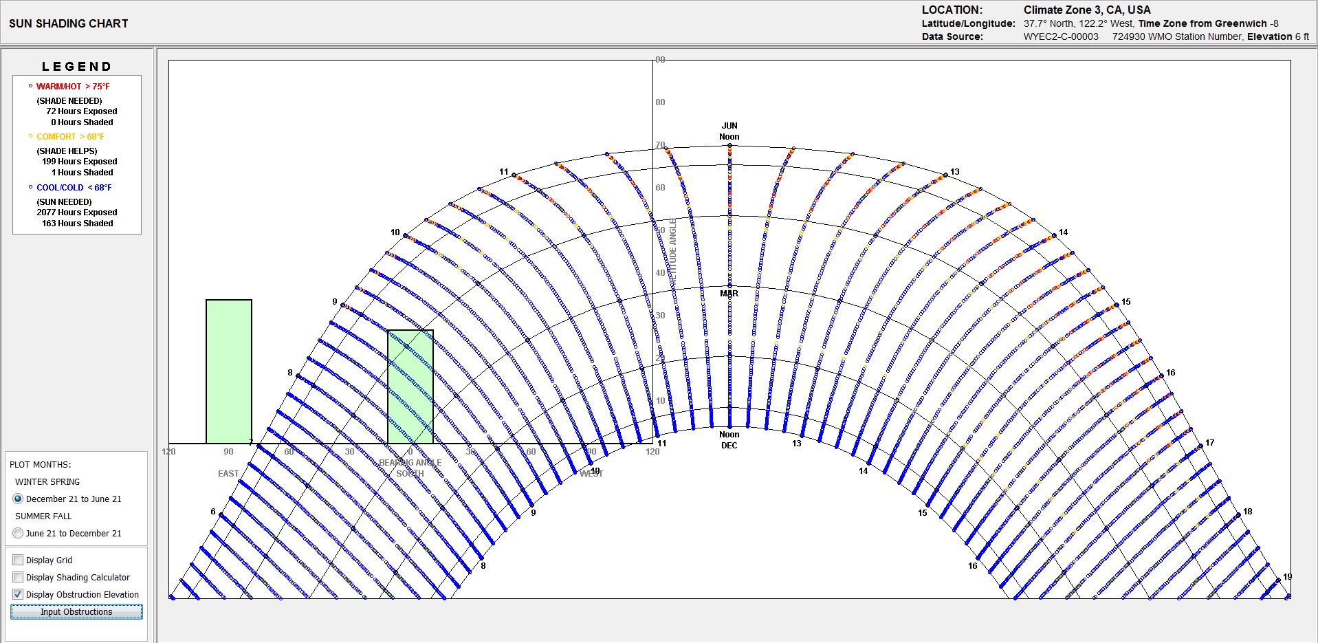
| | 3 | No.3 Revision |
Go as far as needed until it doesn't affect your building anymore.
Couple of pointers as to where I would start:
Model it in sketchup and enable shading so you can get visual 3D feel for what's happening.
Use any software such as Climate Consultant to easily produce a Sun Shading Chart. It also has an "obstruction elevation" where you can enter neighboring buildings (distance, elevations, and which orientation) and it'll show you how much of your sun you're blocking.
Below I've added two obstructions, one that has no impact (100 ft high, 15 ft away, but East orientation) and one that has some impact (full south, 50ft high, 100 ft away)
If you feel like going further, it'll be a good occasion to refresh your skills in trigonometry in 3D polar coordinates.
Edit:
I just remembered that there's some Python framework called PV_LIB to model solar PV. Sure enough, there's already a function to calculate the position of the sun given location: latitude, longitude and elevation (and time zone). Check the source code for the pvl_ephemeris function here


