More detailed version of ResStock's 216 TMY3 Region Map


Hi all,
I am wondering if there is a more spatially granular/labeled version of the following map presented in NRELs report on ResStock's framework. When I zoom in on this map, it gets really blurry, and furthermore I can't tell which TMY3 file in location.tsv (withing the housing_characteristics directory) is which color on the map.
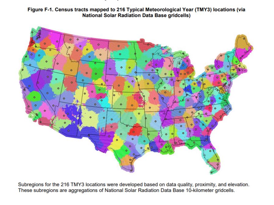
This is from Appendix F in the ResStock report (here: https://www.nrel.gov/docs/fy18osti/68...). This details how the contiguous U.S. was segmented in 216 different regions each assigned to a particular TMY3 file.
I am asking because the particular geographic area I am trying to model seems to be on the boundary of many different regions in the map, and I need to determine which one to use.
add a comment