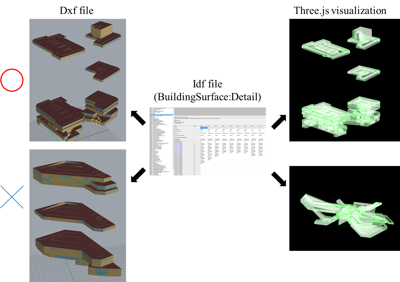
How dxf file can construct geometry based on idf file?


I am trying to write script to visualize 3d file in web browser using Three.js.
I get all the coordinate from BuildingSurface:Detail and give it to the script.
In some cases, it works as shown upper side of the image. But when I export idf file from OpenStudio and extract data, it didn't work as bottom right side even though dxf file exported from source idf file can show the geometry correctly as shown bottom left side.
When I look at idf file, it seems that the one from OpenStudio use relative coordinate checking z coordinate of surfaces. This is the reason why three.js cannot visualize geometry correctly.
But why dxf file can visualize geometry correctly?
I checked GlobalGeometryRules, but both case are using same setting.

Have you tried the View Model measure? It creates a
report.htmlin the model directory that visualizes geometry in the OS app or a browser (source code).Thank you. I will give it a try. I am curious what kind of input differentiate these two cases. Do you have any idea?